Open for business AdamFebruary 26, 2023February 4, 2024Aerial photography, Art and design, community, data collection, data services, data wrangling, fieldwork, good data, illustration, News, open data, open systems, QGIS, Research, training, visualisation
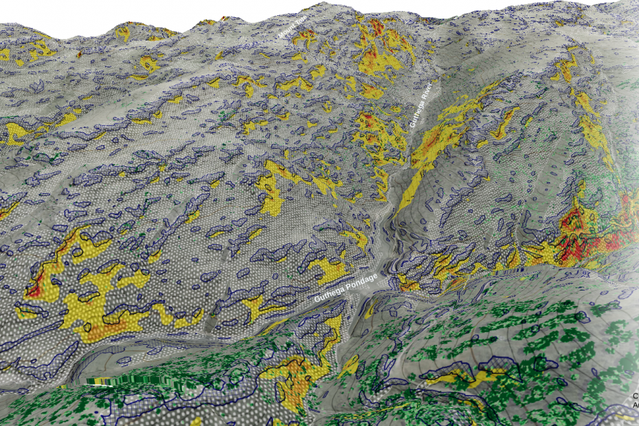
Mapping avalanche risk factors AdamApril 3, 2021February 14, 2023DTM, foss4g, Geohazards, Lidar, open data, PDAL, Research, Uncategorized
The maps we are, the maps we make AdamAugust 2, 2020January 27, 2024open data, open systems, philosophy, Strategy, culture, advice
Lidar processing with PDAL, WMTS and geobash AdamMay 30, 2020January 24, 2024Aerial photography, data mining, data services, data wrangling, entwine, foss4g, GDAL, Lidar, Lidar and bathymetry, open data, PDAL
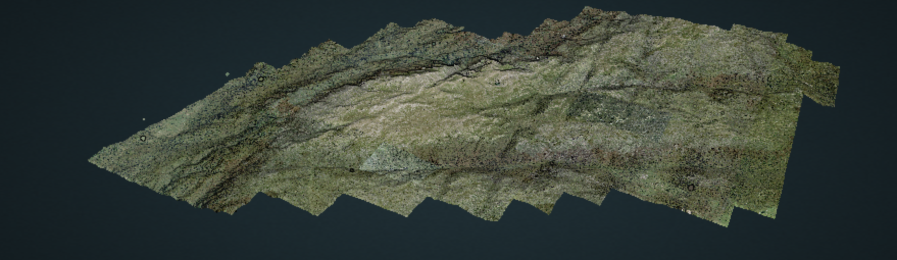
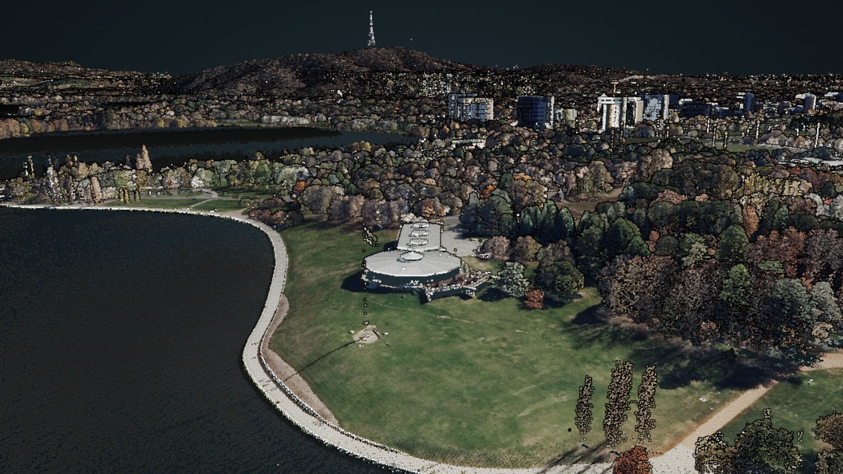
10 000 square kilometres AdamMay 7, 2020February 6, 2024data services, data wrangling, entwine, infrastructure, Lidar, Lidar and bathymetry, open data, OSGeo, PDAL, philosophy, Potree, Research, training, visualisation
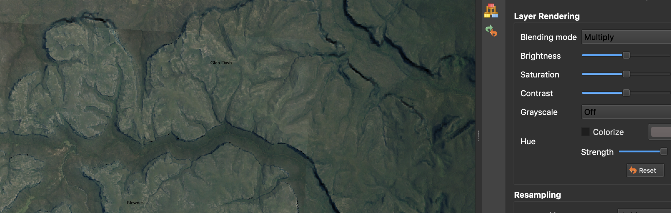
‘Painting’ terrain in QGIS AdamMarch 27, 2020May 31, 2020Cartography, data wrangling, DTM, GDAL, Lidar, open data, QGIS, visualisation
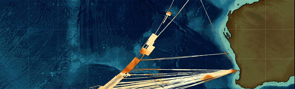
Making the MH370 map AdamMarch 14, 2019April 26, 2020Bathymetry, Cartography, data wrangling, Lidar and bathymetry, open data, PDAL, QGIS
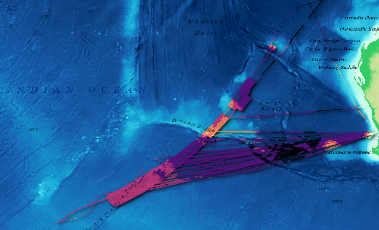
An open source point cloud infrastructure part 2: oceans AdamJanuary 7, 2019August 30, 2020Bathymetry, Cartography, data services, data wrangling, entwine, infrastructure, Lidar and bathymetry, open data, PDAL, QGIS
An open source point cloud data infrastructure: introduction, and land. AdamDecember 27, 2018July 9, 2020data mining, data services, entwine, infrastructure, Lidar, Lidar and bathymetry, open data, PDAL, Potree