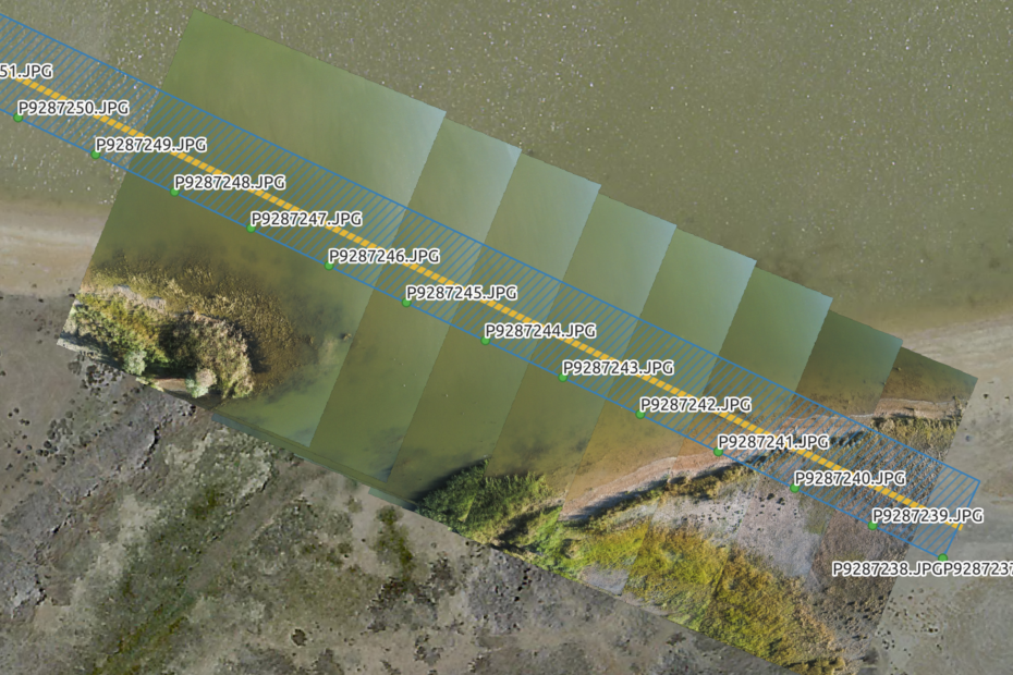
Image transects for ecological assessment AdamMarch 6, 2024March 8, 2024Aerial photography, ANAFI, data collection, Drone projects, fieldwork, QGIS
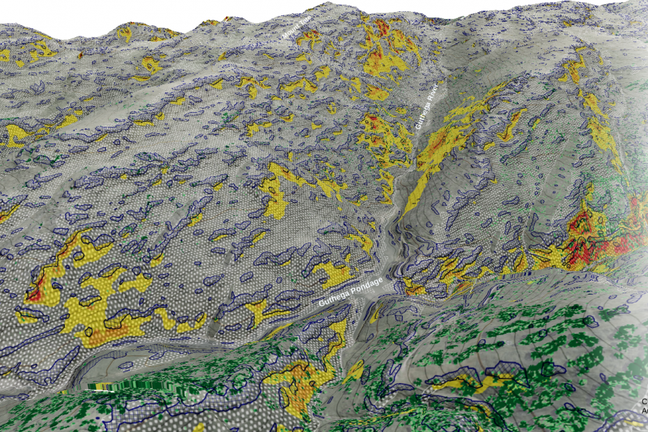
Route mapping using Strava, OpenStreetMap and QQIS AdamFebruary 4, 2024February 5, 2024Cartography, DTM, foss4g, QGIS, visualisation
Open for business AdamFebruary 26, 2023February 4, 2024Aerial photography, Art and design, community, data collection, data services, data wrangling, fieldwork, good data, illustration, News, open data, open systems, QGIS, Research, training, visualisation
Mapping a small farm part 1: basemap data collection AdamJuly 12, 2020July 13, 2020ANAFI, data collection, data wrangling, Drone projects, field survey, Lidar and bathymetry, Photogrammetry, QGIS, visualisation
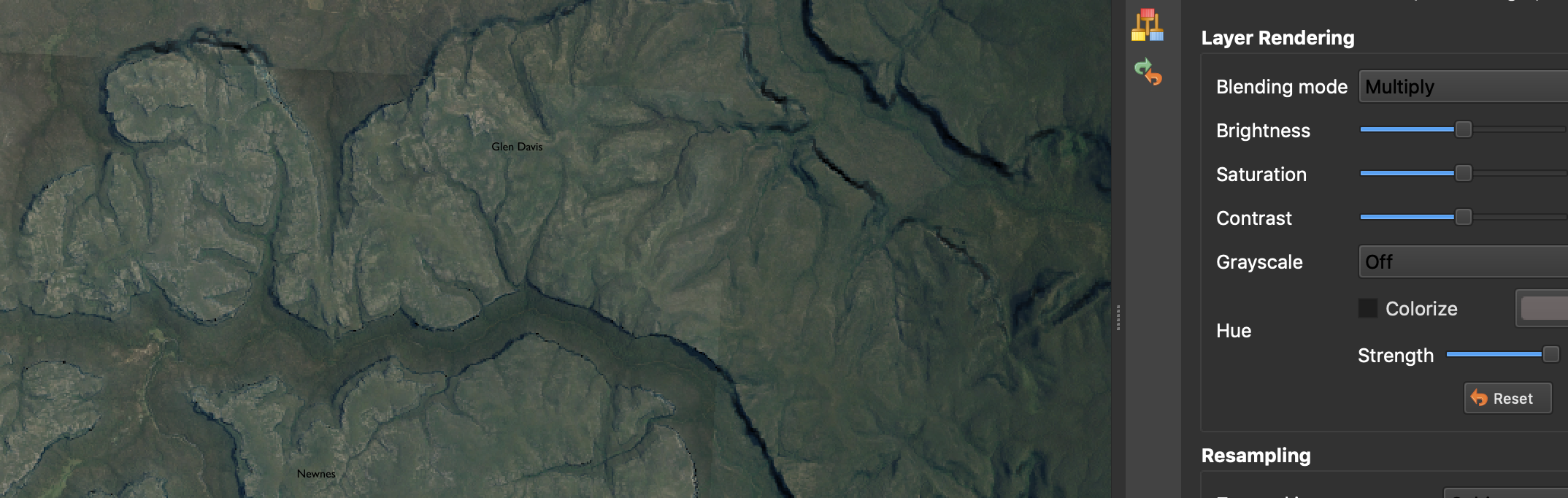
‘Painting’ terrain in QGIS AdamMarch 27, 2020May 31, 2020Cartography, data wrangling, DTM, GDAL, Lidar, open data, QGIS, visualisation
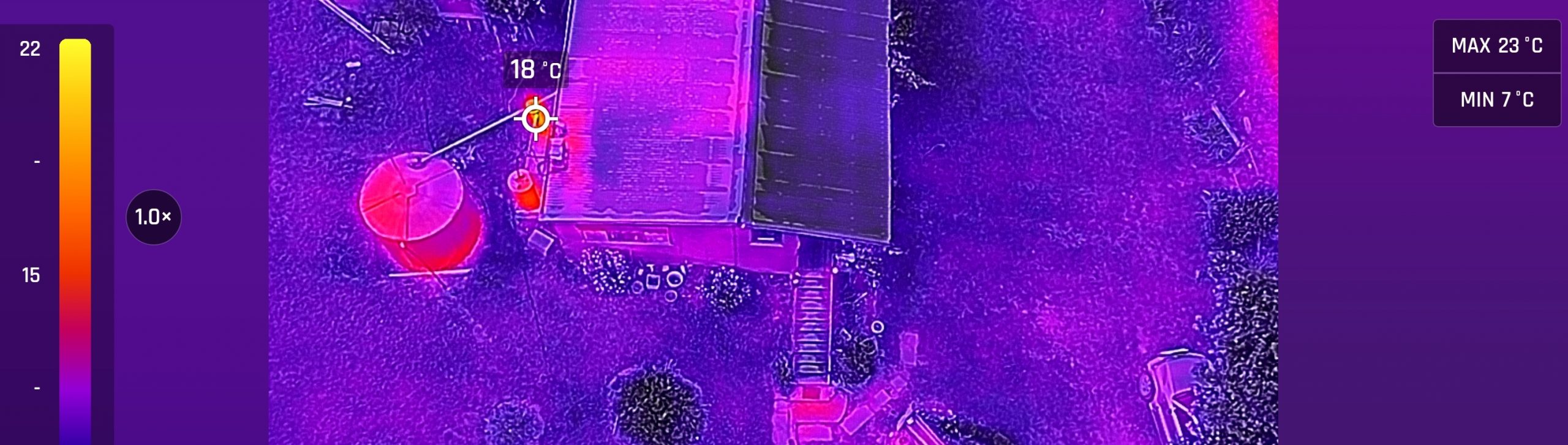
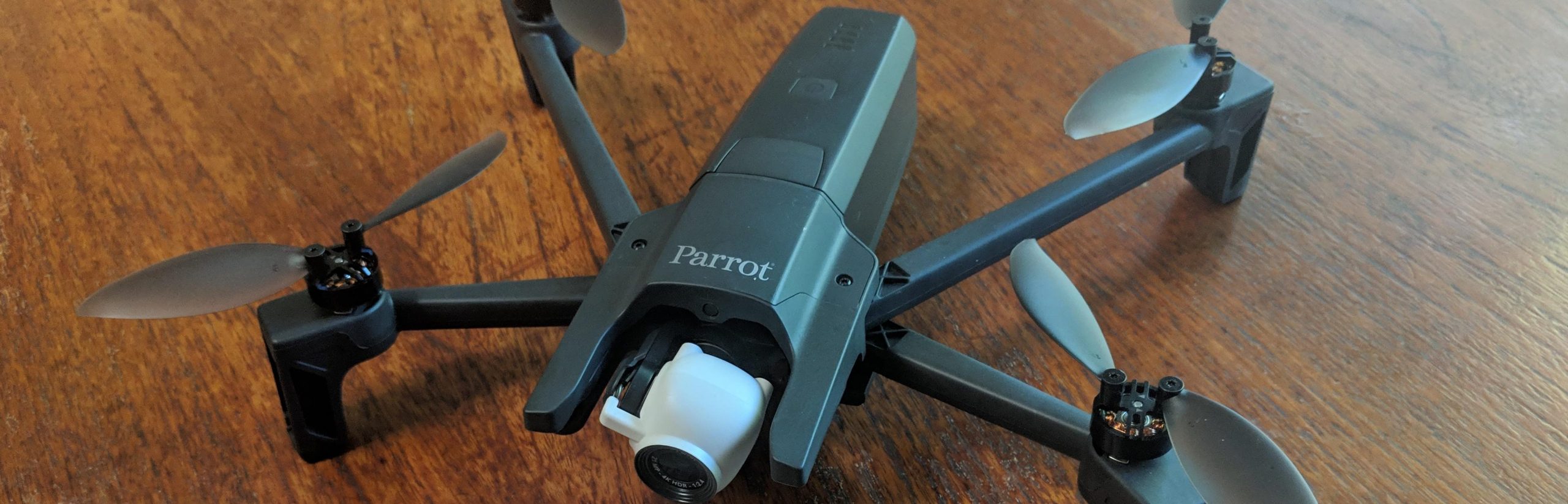
Introducing the ANAFI thermal AdamJanuary 24, 2020October 5, 2023ANAFI, Cartography, data collection, data wrangling, Drone projects, field survey, fieldwork, Lidar and bathymetry, Photogrammetry, QGIS, visualisation
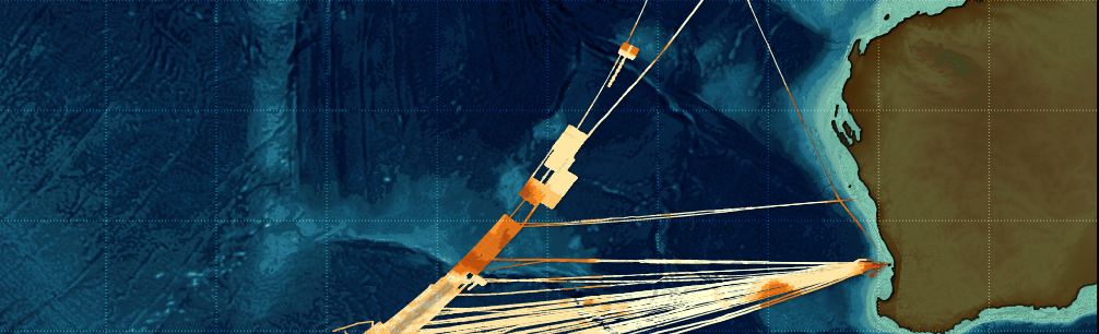
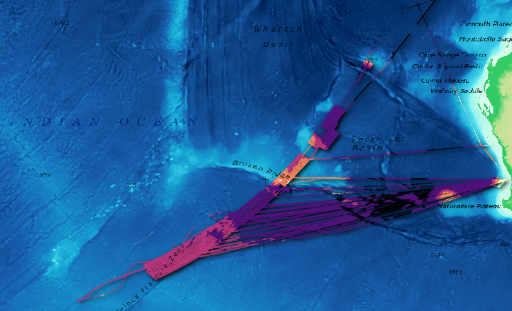
Making the MH370 map AdamMarch 14, 2019April 26, 2020Bathymetry, Cartography, data wrangling, Lidar and bathymetry, open data, PDAL, QGIS
Experiments with Anafi – and point cloud infrastructure part 3 AdamFebruary 13, 2019March 1, 2021ANAFI, data collection, data wrangling, entwine, field survey, infrastructure, Lidar, Lidar and bathymetry, PDAL, Photogrammetry, QGIS
An open source point cloud infrastructure part 2: oceans AdamJanuary 7, 2019August 30, 2020Bathymetry, Cartography, data services, data wrangling, entwine, infrastructure, Lidar and bathymetry, open data, PDAL, QGIS
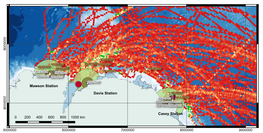
A short visual history of shipping access to Australian Antarctic stations AdamJanuary 4, 2015February 2, 2024ACE CRC, Antarctic, Cartography, data collection, data mining, QGIS