
Important update:
The data described below are no longer publicly available because we ran out of disposable funding to keep them alive, and also don’t want to deal with Amazon any more. I’ve picked Backblaze as the next storage provider, and will reinstate the data as soon as there’s a spare $30 a month coming in to host it. Lucky for you, egress from Backblaze B2 is free – so you can do what you like with the data once they’re back!
Spatialised holds the data locally, reach out if you’re in the market for some data products in the regions below – noting that some dataets are now well out of currency. Feel free to drop a line if you’re sitting on a heap of lidar and want it prepared for cloud-based clip-and-ship ready storage! I also recommend Howard Butler and team at Hobu – who are the primary builders and maintainers of all the open source tools I use to do this stuff.
The original story…
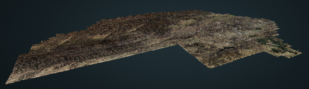
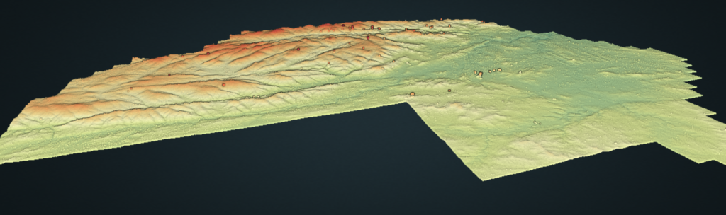
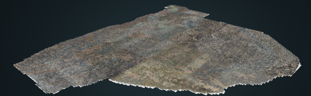
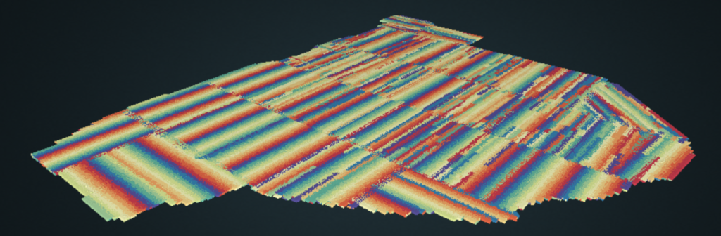
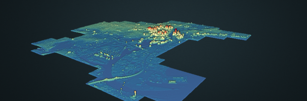
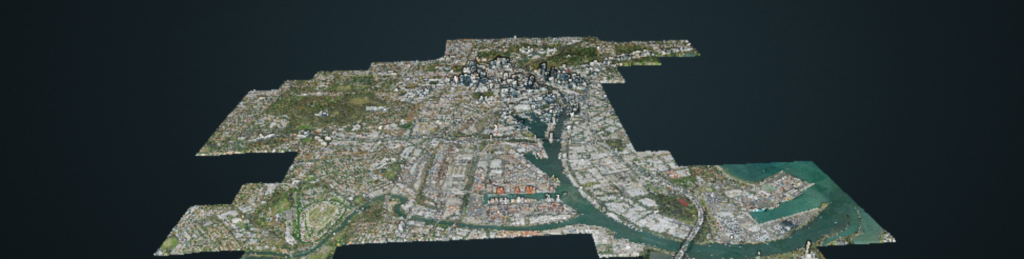
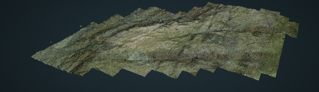
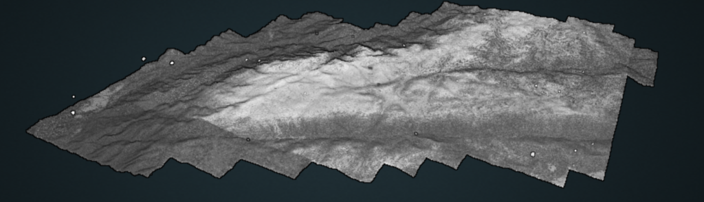
As of early May in 2020, Spatialised hosts over 10 000 square kilometres and 60-something-billion points of open lidar data over the Australian mainland, plus massive swathes of Indian Ocean bathymetry collected in the search for the missing airliner MH370. These datasets all arrived as proof-of-concept works – developed in order to showcase capabilities of open source point cloud management and processing tools. You can explore all this data in your web browser (except Safari) here: https://spatialised.net/pointclouds/
I’ve colourised, translated, and hosted these data; provided tutorial stories on how to use them; travelled to deliver free workshops on point cloud data processing, and contributed back to the software and community which makes all this happen. I’ve approached this with an artist’s mindset: create stuff, and see what the world likes!
I also have a massive ethical issue over all of this – the standard business model is to lock data away, put a payment gateway over it and charge you for it. However – that is totally at odds with the giving culture we find ourselves part of in the open source geospatial ecosystem.
It’s all government-collected data that someone else paid for. It is all processed with open tools which are freely given to the geospatial community.
Yes, the data are made prettier and easier to use. It still seems weird to charge money to use it. It’s all reprocessing data that already exists in the public domain, and it really doesn’t jive to wrap it up and claim it is special because things have been tweaked it a bit.
Likewise, claiming special awesomeness by putting open source geospatial tooling behind walls doesn’t jive. At Spatialised, we think it is possible either to protect IP or innovate – but not both. The aim is building for an open and diverse future, not sitting on past achievements!
Returning to the artist analogy again: I don’t specialise in making paint, I don’t specialise in making canvas – I specialise in mixing the two and see what comes out (although sometimes, I tinker with the brushes to make them better, or decide that fingers are better). And from that experience, knowing what needs to go into great paint, brushes and canvas!
The whole point of Spatialised isn’t to take over the world or get bought out or be the most expert – it is to provide meaningful output and tooling for people to use, and help people along their own geospatial journeys. It’s not all about being always the smartest or the fastest or the most ambitious. It is all about creative exploration and geo-artistry, doing things this way because it would seriously compromise us to do it any other way.
There is a plan to revive pointWPS as a whiteboxed application, and sell convenience-as-a-service if you don’t like the hassle of writing point cloud processing pipelines – however, even the mechanics of that will be fully open for you to inspect (this is critical if you’re needing research data or have legal obligations – to know exactly what was done). And ethically speaking, we’re not in the business of selling things that were gifted to us!
With all that in mind, look out for more awesome point clouds and (open) ways to get useful things from them soon…
The sales pitch
Spatialised is a fully independent consulting business. Everything you see here is open for you to use and reuse, without ads. WordPress sets a few cookies for statistics aggregation, we use those to see how many visitors we got and how popular things are.
If you find the content here useful to your business or research or billion dollar startup idea, you can support production of ideas and open source geo-recipes via Paypal, hire me to do stuff; or hire me to talk about stuff.