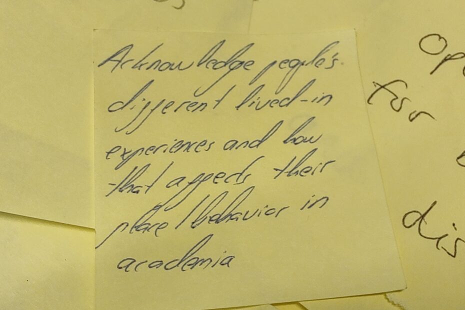
Better science workshops AdamMay 3, 2023January 27, 2024community, Culture, philosophy, Research, Strategy, culture, advice, training
Open for business AdamFebruary 26, 2023February 4, 2024Aerial photography, Art and design, community, data collection, data services, data wrangling, fieldwork, good data, illustration, News, open data, open systems, QGIS, Research, training, visualisation
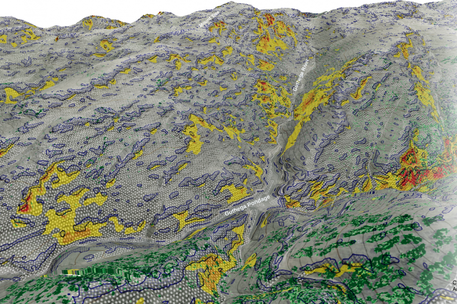
Mapping avalanche risk factors AdamApril 3, 2021February 14, 2023DTM, foss4g, Geohazards, Lidar, open data, PDAL, Research, Uncategorized
Artisanal geoconsulting AdamSeptember 6, 2020February 4, 2024Aerial photography, Cartography, data collection, data wrangling, field survey, fieldwork, News, Photogrammetry, Research, Tiny planets, training, visualisation
10 000 square kilometres AdamMay 7, 2020February 6, 2024data services, data wrangling, entwine, infrastructure, Lidar, Lidar and bathymetry, open data, OSGeo, PDAL, philosophy, Potree, Research, training, visualisation
Approaches to aerial photo quality with GDAL + openCV AdamApril 17, 2020January 29, 2024Aerial photography, data wrangling, FrontierSI, Photogrammetry, Research, Spatial data science