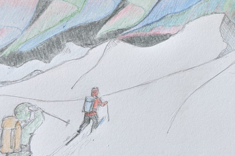
Artisanal geoconsulting AdamSeptember 6, 2020February 4, 2024Aerial photography, Cartography, data collection, data wrangling, field survey, fieldwork, News, Photogrammetry, Research, Tiny planets, training, visualisation
Mapping a small farm part 1: basemap data collection AdamJuly 12, 2020July 13, 2020ANAFI, data collection, data wrangling, Drone projects, field survey, Lidar and bathymetry, Photogrammetry, QGIS, visualisation
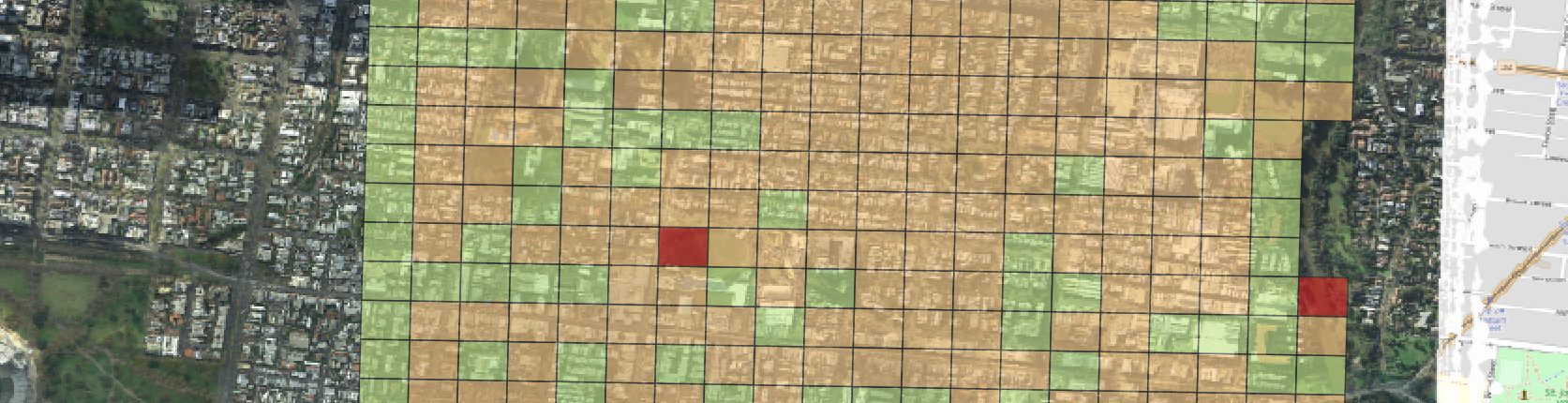
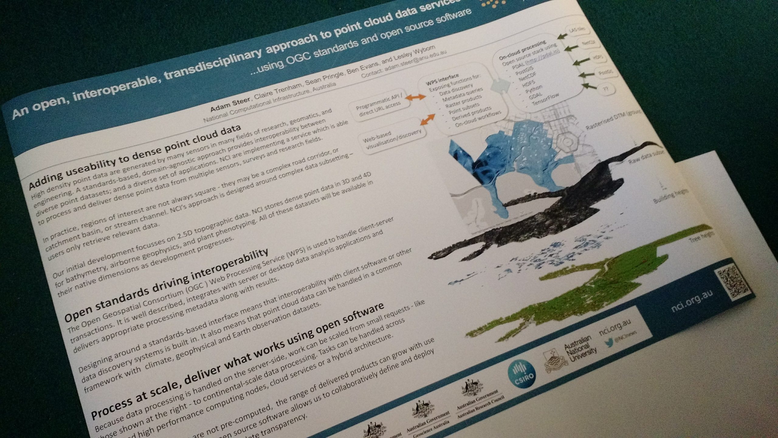
Approaches to aerial photo quality with GDAL + openCV AdamApril 17, 2020January 29, 2024Aerial photography, data wrangling, FrontierSI, Photogrammetry, Research, Spatial data science
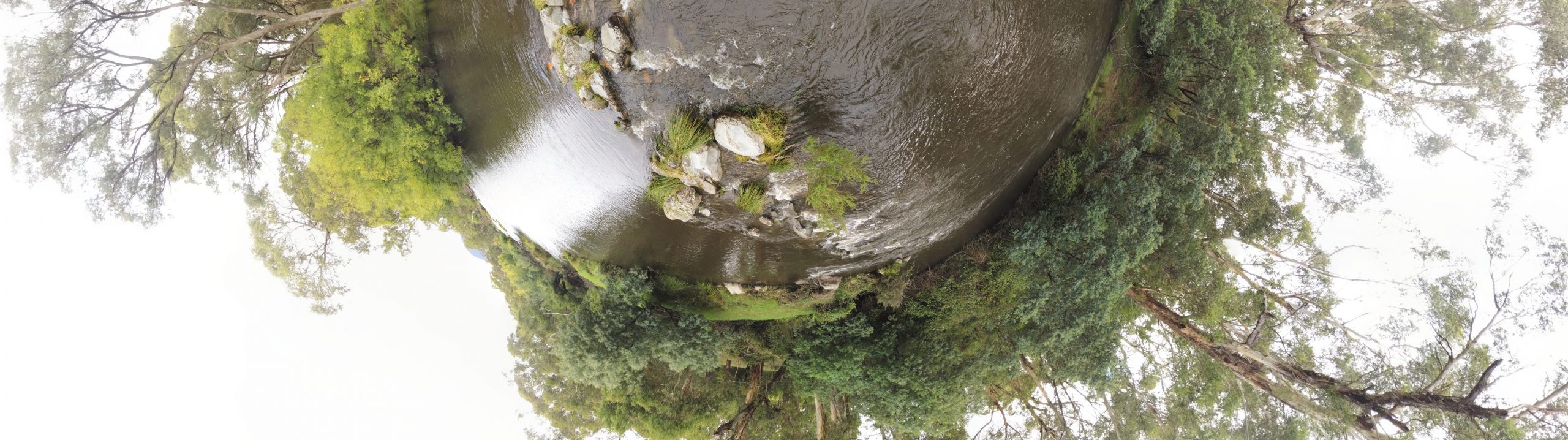
Little planets and tree structures AdamMarch 13, 2020January 29, 2024Aerial photography, ANAFI, Drone projects, Lidar and bathymetry, Photogrammetry, Tiny planets
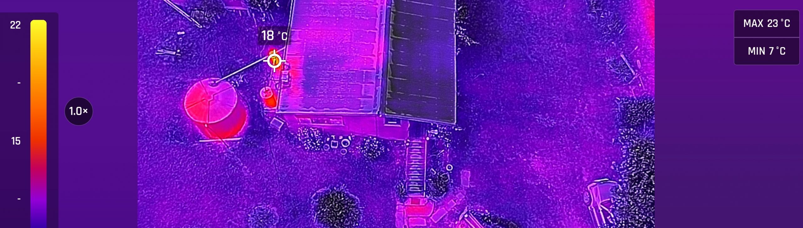
Introducing the ANAFI thermal AdamJanuary 24, 2020October 5, 2023ANAFI, Cartography, data collection, data wrangling, Drone projects, field survey, fieldwork, Lidar and bathymetry, Photogrammetry, QGIS, visualisation
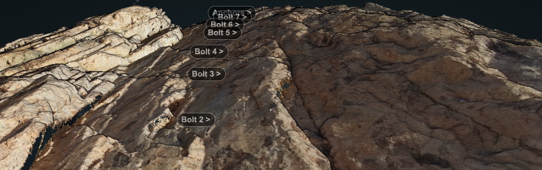
Rock faces and RPAS AdamSeptember 22, 2019September 22, 2019ANAFI, Drone projects, entwine, field survey, Lidar and bathymetry, PDAL, Photogrammetry, visualisation
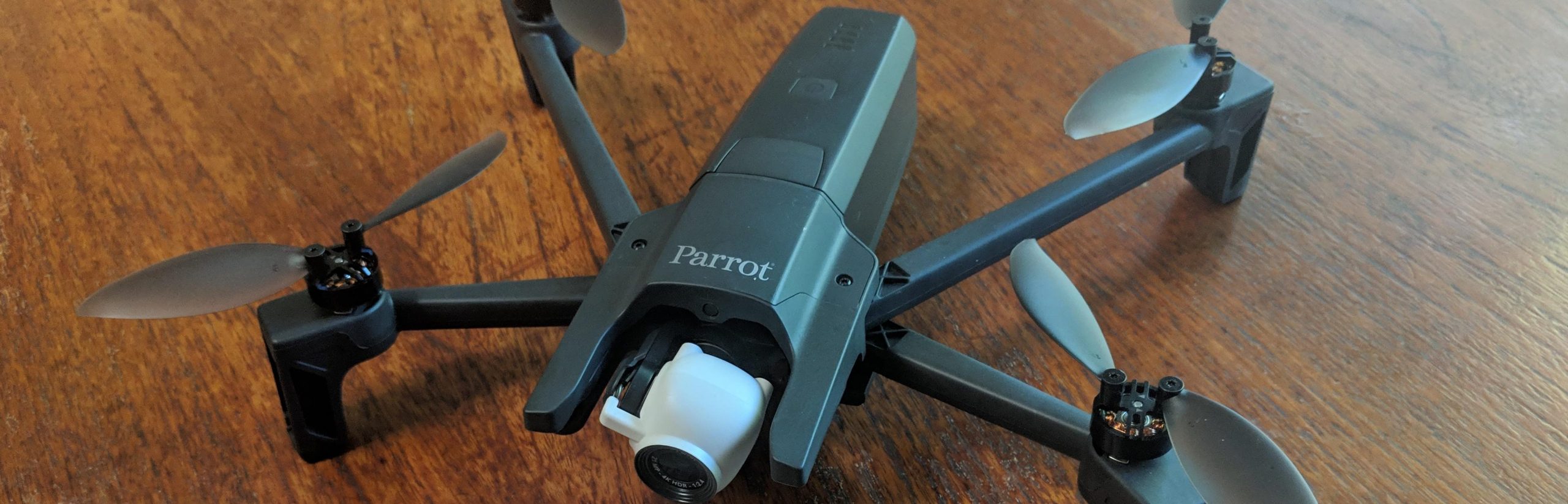
Experiments with Anafi – and point cloud infrastructure part 3 AdamFebruary 13, 2019March 1, 2021ANAFI, data collection, data wrangling, entwine, field survey, infrastructure, Lidar, Lidar and bathymetry, PDAL, Photogrammetry, QGIS
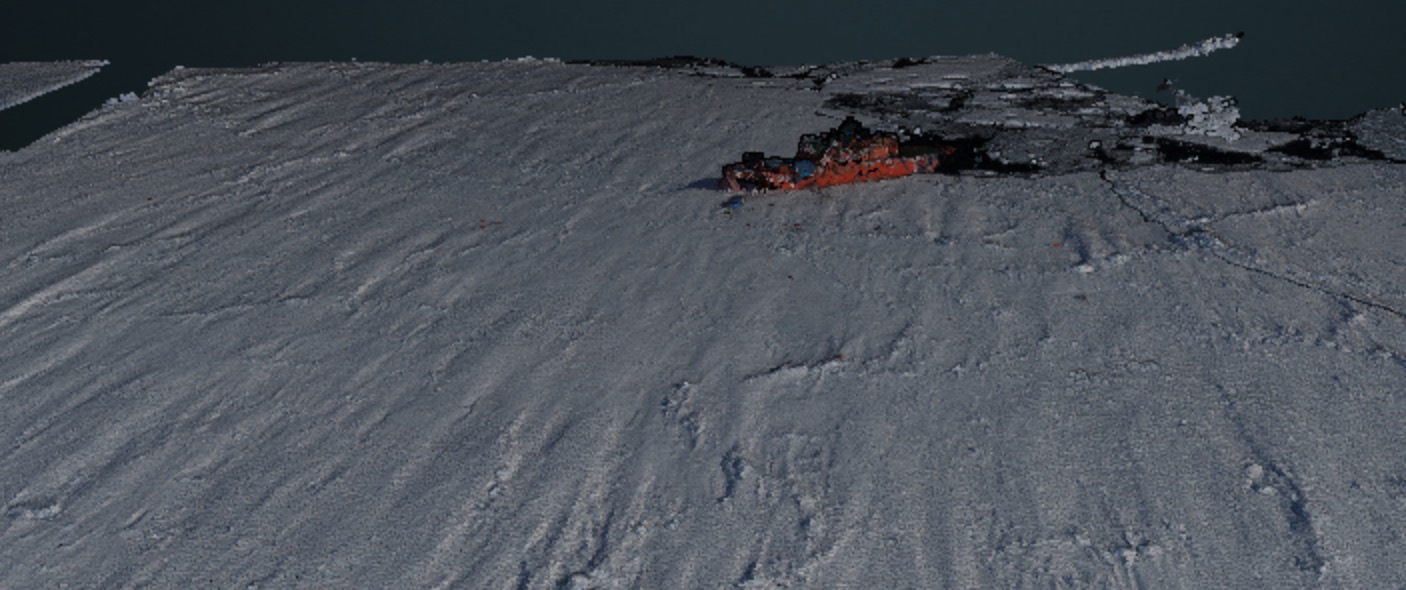
More sea ice reconstructions AdamNovember 18, 2018November 22, 2018ACE CRC, Antarctic, data collection, data mining, field survey, Lidar and bathymetry, Photogrammetry, Sea ice
Ice floe interactive visualisation, take 1 AdamJuly 26, 2018December 21, 2018ACE CRC, Antarctic, field survey, Lidar and bathymetry, Photogrammetry, Sea ice
Drifting sea ice and 3D photogrammetry AdamMarch 3, 2017March 4, 2017Antarctic, DTM, field survey, fieldwork, Photogrammetry, Sea ice