Open for business AdamFebruary 26, 2023February 4, 2024Aerial photography, Art and design, community, data collection, data services, data wrangling, fieldwork, good data, illustration, News, open data, open systems, QGIS, Research, training, visualisation
Artisanal geoconsulting AdamSeptember 6, 2020February 4, 2024Aerial photography, Cartography, data collection, data wrangling, field survey, fieldwork, News, Photogrammetry, Research, Tiny planets, training, visualisation
Mapping a small farm part 1: basemap data collection AdamJuly 12, 2020July 13, 2020ANAFI, data collection, data wrangling, Drone projects, field survey, Lidar and bathymetry, Photogrammetry, QGIS, visualisation
Lidar processing with PDAL, WMTS and geobash AdamMay 30, 2020January 24, 2024Aerial photography, data mining, data services, data wrangling, entwine, foss4g, GDAL, Lidar, Lidar and bathymetry, open data, PDAL
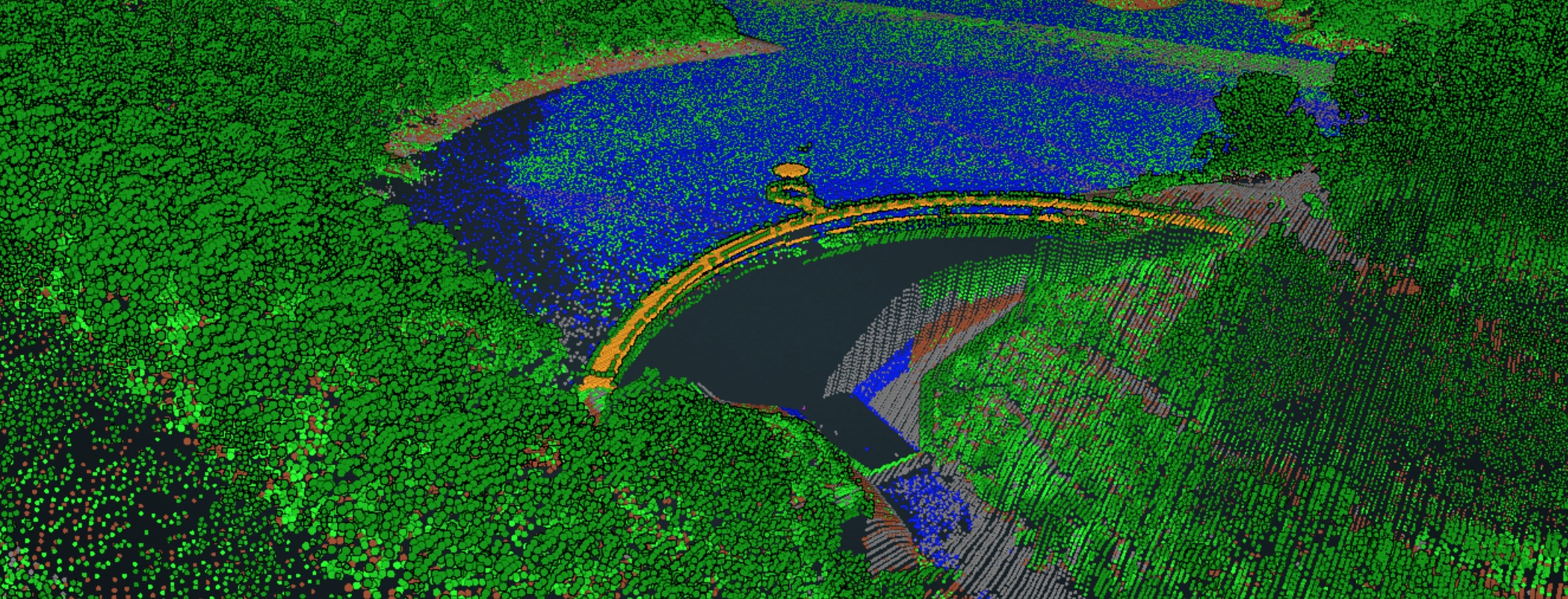
10 000 square kilometres AdamMay 7, 2020February 6, 2024data services, data wrangling, entwine, infrastructure, Lidar, Lidar and bathymetry, open data, OSGeo, PDAL, philosophy, Potree, Research, training, visualisation
Open lidar QA with PDAL part 1: inspecting LAS files AdamMay 2, 2020May 16, 2020data mining, data wrangling, entwine, Lidar, PDAL
Approaches to aerial photo quality with GDAL + openCV AdamApril 17, 2020January 29, 2024Aerial photography, data wrangling, FrontierSI, Photogrammetry, Research, Spatial data science
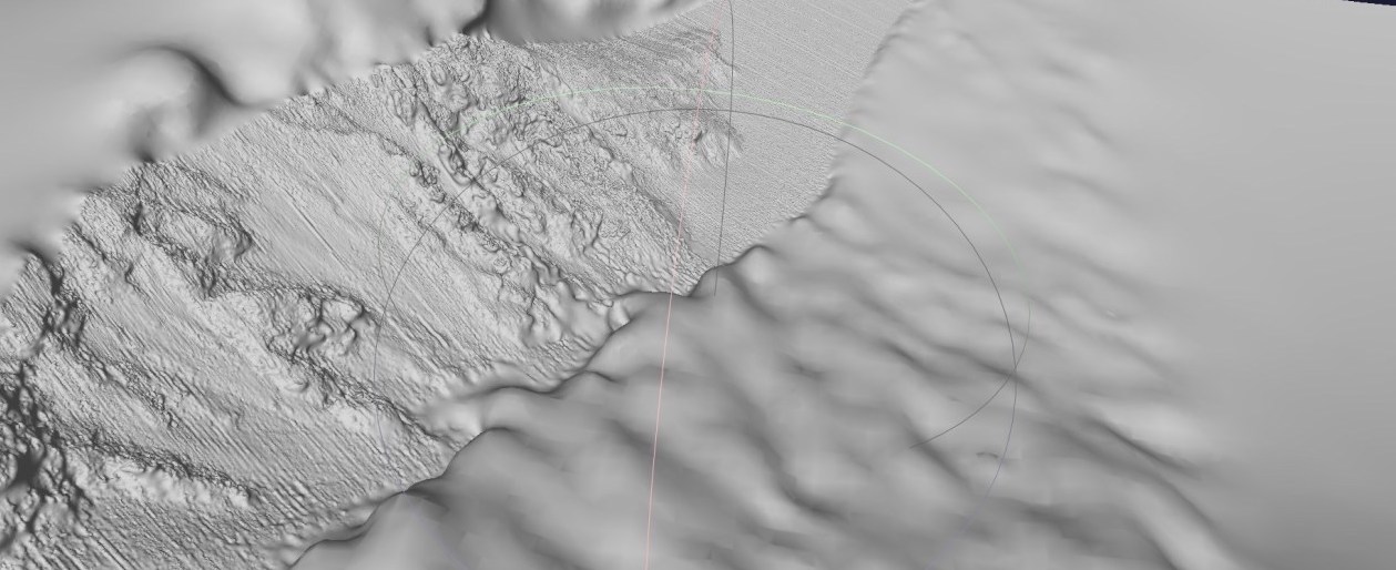
‘Painting’ terrain in QGIS AdamMarch 27, 2020May 31, 2020Cartography, data wrangling, DTM, GDAL, Lidar, open data, QGIS, visualisation
Emergency services, aerial imagery, GDAL, S3 and rapid team building AdamMarch 20, 2020January 29, 2024Aerial photography, data wrangling, foss4g, GDAL, Spatial data science
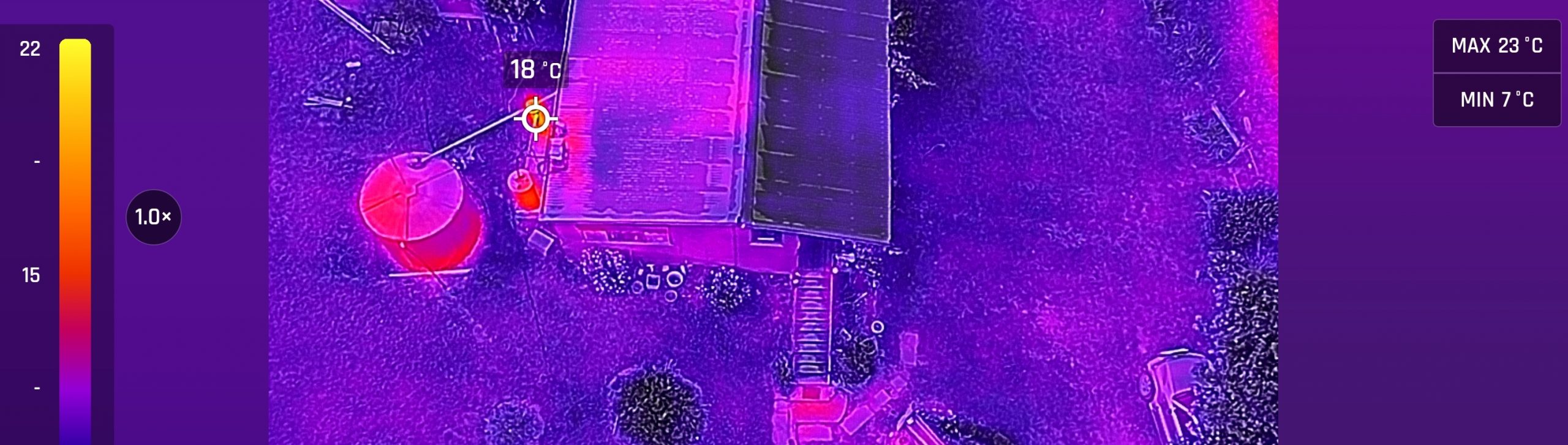
Introducing the ANAFI thermal AdamJanuary 24, 2020October 5, 2023ANAFI, Cartography, data collection, data wrangling, Drone projects, field survey, fieldwork, Lidar and bathymetry, Photogrammetry, QGIS, visualisation
FAIRER Data AdamJune 11, 2019January 27, 2024data collection, data wrangling, good data, Strategy, culture, advice
Colouring point clouds with PDAL AdamJune 1, 2019May 8, 2020data wrangling, entwine, Lidar, Lidar and bathymetry, PDAL, visualisation
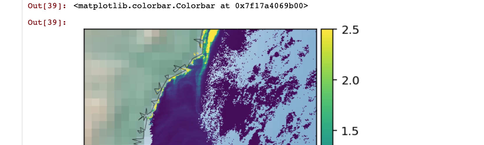
A small hydrographic data QA project AdamApril 3, 2019April 3, 2019Bathymetry, data services, data wrangling, FrontierSI, open systems, PDAL
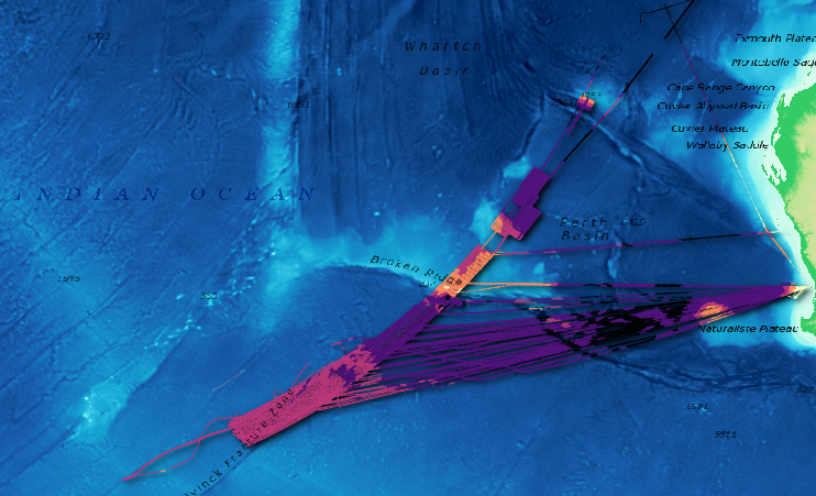
Making the MH370 map AdamMarch 14, 2019April 26, 2020Bathymetry, Cartography, data wrangling, Lidar and bathymetry, open data, PDAL, QGIS
Web services: NCSS and WCS AdamMarch 6, 2019February 7, 2024data mining, data services, data wrangling, Spatial data science, training
Experiments with Anafi – and point cloud infrastructure part 3 AdamFebruary 13, 2019March 1, 2021ANAFI, data collection, data wrangling, entwine, field survey, infrastructure, Lidar, Lidar and bathymetry, PDAL, Photogrammetry, QGIS
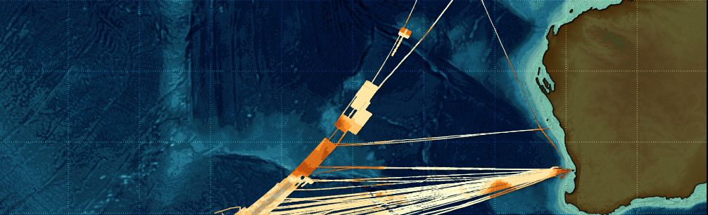
An open source point cloud infrastructure part 2: oceans AdamJanuary 7, 2019August 30, 2020Bathymetry, Cartography, data services, data wrangling, entwine, infrastructure, Lidar and bathymetry, open data, PDAL, QGIS
Open AgTech – a prelude AdamNovember 1, 2018January 27, 2024data collection, data services, data wrangling, open systems, philosophy, Strategy, culture, advice