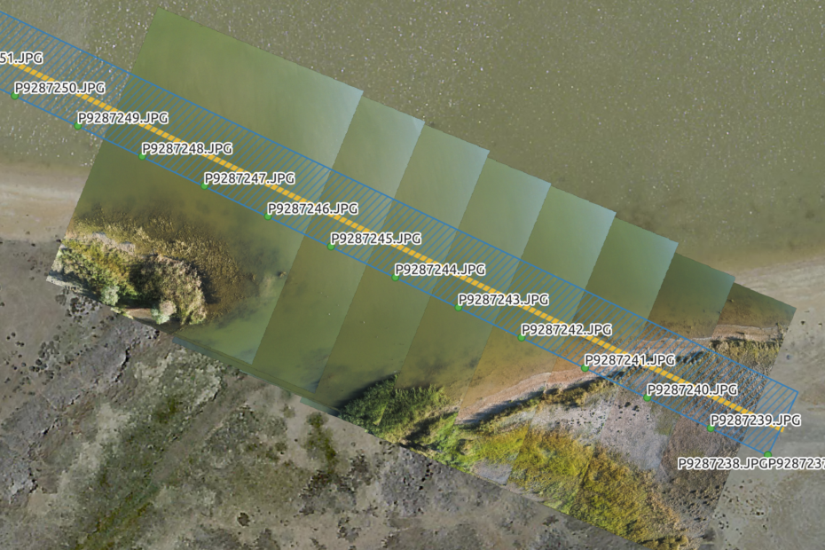
Image transects for ecological assessment AdamMarch 6, 2024March 8, 2024Aerial photography, ANAFI, data collection, Drone projects, fieldwork, QGIS
Mapping a small farm part 1: basemap data collection AdamJuly 12, 2020July 13, 2020ANAFI, data collection, data wrangling, Drone projects, field survey, Lidar and bathymetry, Photogrammetry, QGIS, visualisation
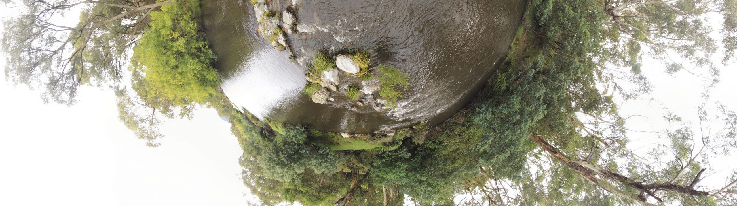
Little planets and tree structures AdamMarch 13, 2020January 29, 2024Aerial photography, ANAFI, Drone projects, Lidar and bathymetry, Photogrammetry, Tiny planets
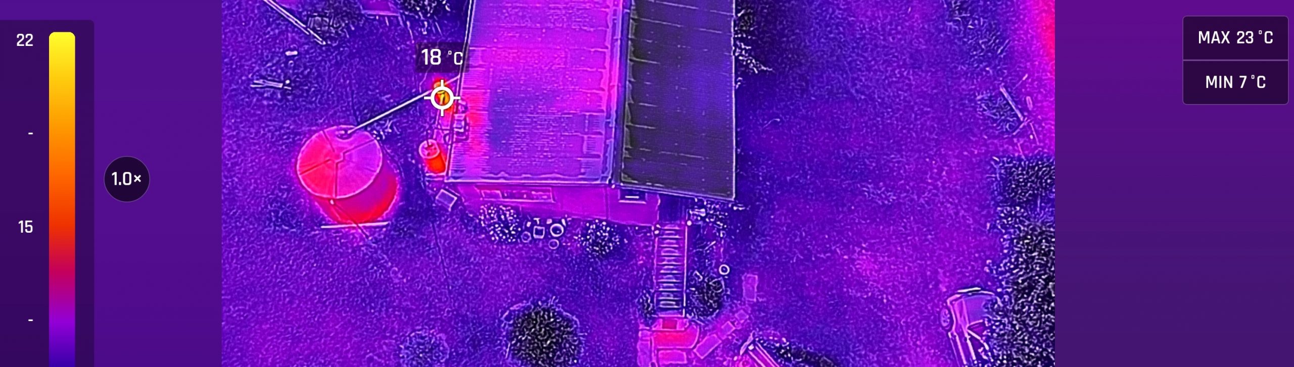
Introducing the ANAFI thermal AdamJanuary 24, 2020October 5, 2023ANAFI, Cartography, data collection, data wrangling, Drone projects, field survey, fieldwork, Lidar and bathymetry, Photogrammetry, QGIS, visualisation
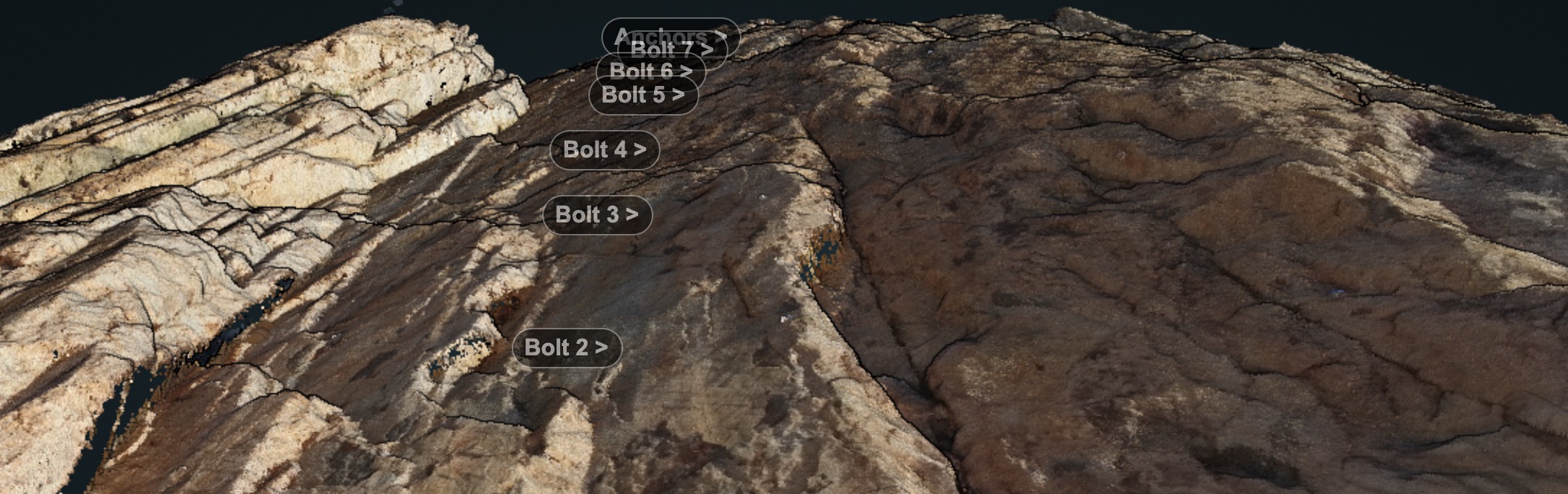
Rock faces and RPAS AdamSeptember 22, 2019September 22, 2019ANAFI, Drone projects, entwine, field survey, Lidar and bathymetry, PDAL, Photogrammetry, visualisation
Experiments with Anafi – and point cloud infrastructure part 3 AdamFebruary 13, 2019March 1, 2021ANAFI, data collection, data wrangling, entwine, field survey, infrastructure, Lidar, Lidar and bathymetry, PDAL, Photogrammetry, QGIS