Lidar thoughts – where to measure, exactly? AdamDecember 24, 2016August 30, 2022data collection, Lidar, Lidar and bathymetry, uncertainties
ACE CRC, Airborne LiDAR and Antarctic sea ice AdamAugust 30, 2015January 12, 2019ACE CRC, Antarctic, data collection, Lidar, Sea ice
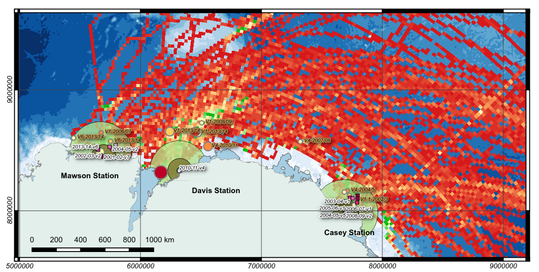
A short visual history of shipping access to Australian Antarctic stations AdamJanuary 4, 2015February 2, 2024ACE CRC, Antarctic, Cartography, data collection, data mining, QGIS
DTM troubleshooting for Spatial Scientific AdamSeptember 6, 2013September 18, 2013DTM, Spatial Scientific
Acquiring prism lock: the cover photo AdamSeptember 5, 2013September 18, 2013data collection, field survey