Route mapping using Strava, OpenStreetMap and QQIS AdamFebruary 4, 2024February 5, 2024Cartography, DTM, foss4g, QGIS, visualisation
Open for business AdamFebruary 26, 2023February 4, 2024Aerial photography, Art and design, community, data collection, data services, data wrangling, fieldwork, good data, illustration, News, open data, open systems, QGIS, Research, training, visualisation
Artisanal geoconsulting AdamSeptember 6, 2020February 4, 2024Aerial photography, Cartography, data collection, data wrangling, field survey, fieldwork, News, Photogrammetry, Research, Tiny planets, training, visualisation
Mapping a small farm part 1: basemap data collection AdamJuly 12, 2020July 13, 2020ANAFI, data collection, data wrangling, Drone projects, field survey, Lidar and bathymetry, Photogrammetry, QGIS, visualisation
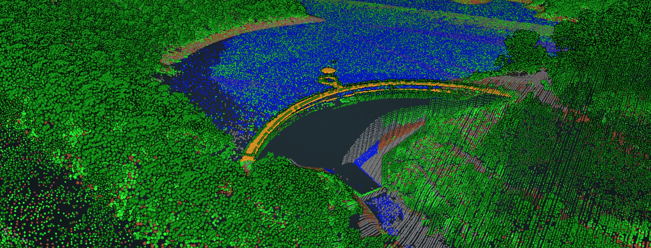
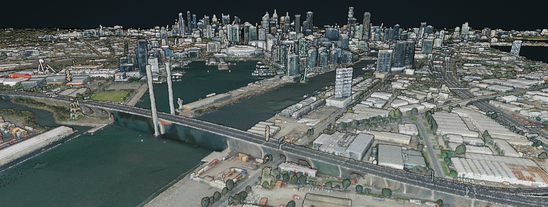
10 000 square kilometres AdamMay 7, 2020February 6, 2024data services, data wrangling, entwine, infrastructure, Lidar, Lidar and bathymetry, open data, OSGeo, PDAL, philosophy, Potree, Research, training, visualisation
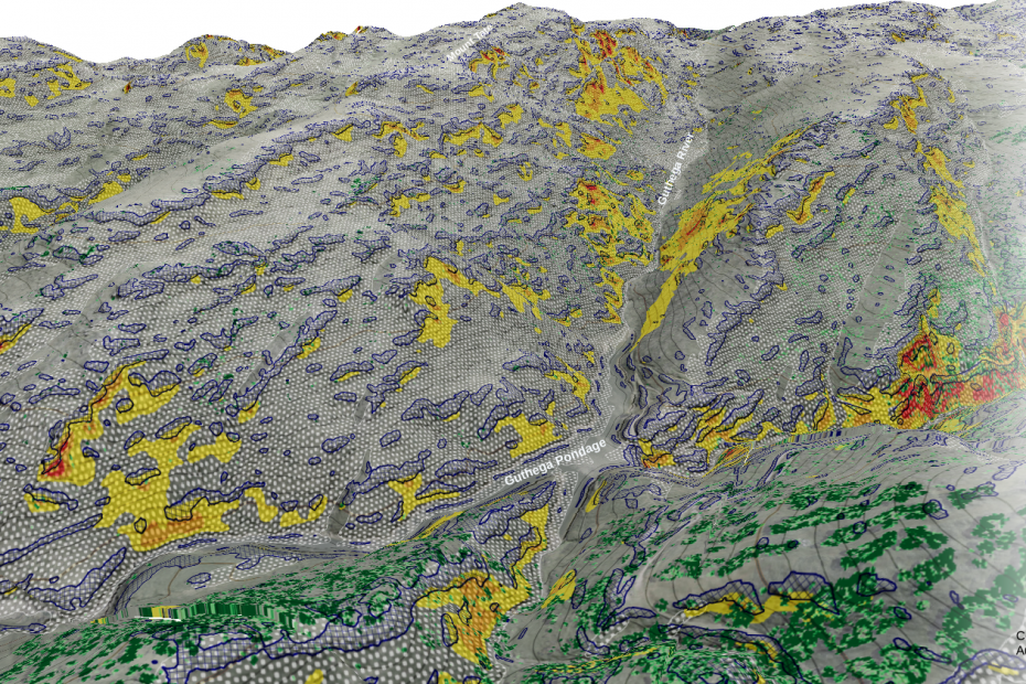
‘Painting’ terrain in QGIS AdamMarch 27, 2020May 31, 2020Cartography, data wrangling, DTM, GDAL, Lidar, open data, QGIS, visualisation
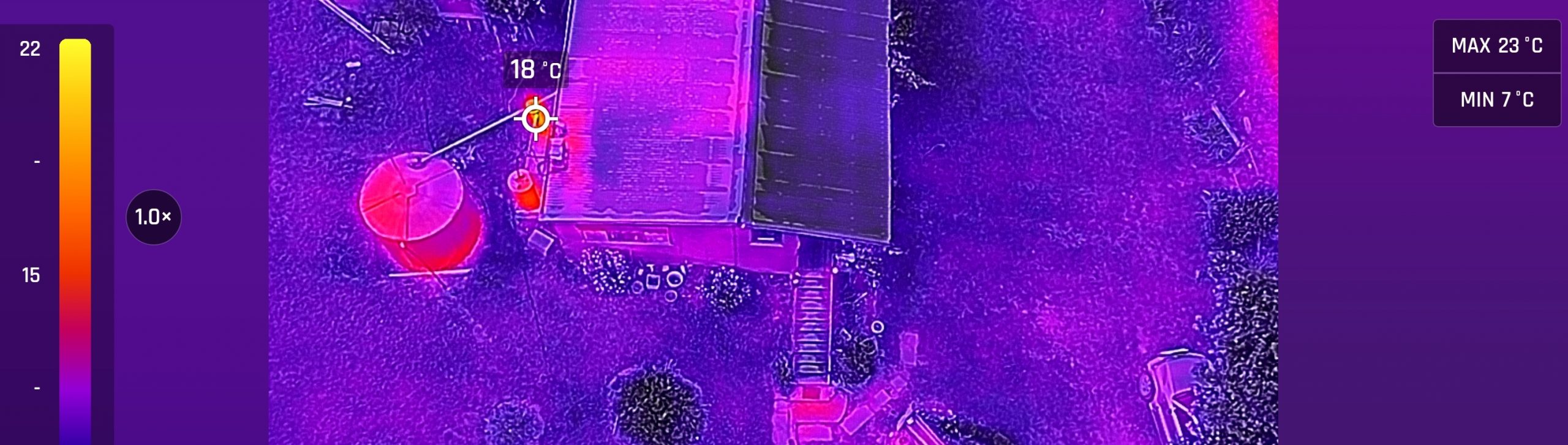
Introducing the ANAFI thermal AdamJanuary 24, 2020October 5, 2023ANAFI, Cartography, data collection, data wrangling, Drone projects, field survey, fieldwork, Lidar and bathymetry, Photogrammetry, QGIS, visualisation
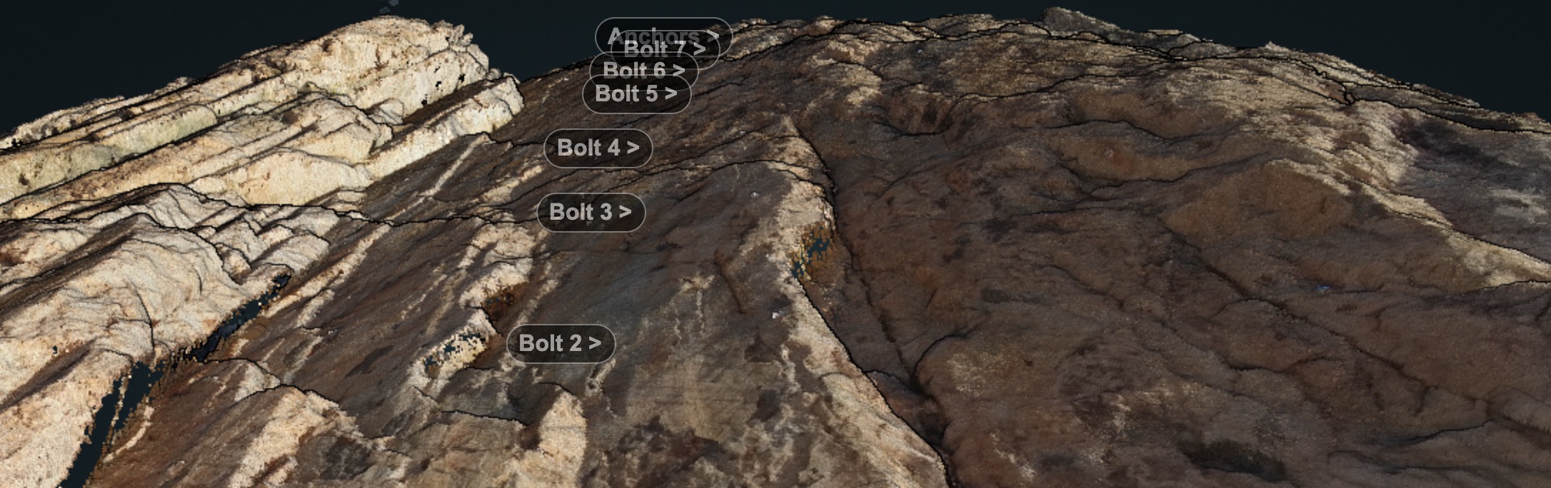
Rock faces and RPAS AdamSeptember 22, 2019September 22, 2019ANAFI, Drone projects, entwine, field survey, Lidar and bathymetry, PDAL, Photogrammetry, visualisation
Colouring point clouds with PDAL AdamJune 1, 2019May 8, 2020data wrangling, entwine, Lidar, Lidar and bathymetry, PDAL, visualisation
A method for offline entwine EPT viewing AdamMarch 28, 2019March 30, 2019entwine, Lidar and bathymetry, Potree, visualisation